. | .
. | .
A strong storm system will be moving into the region this week, bringing multiple hazards with it.
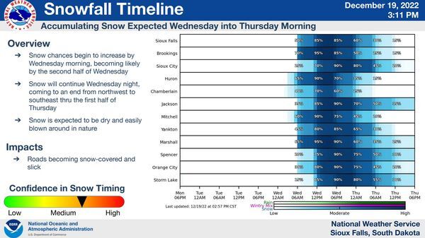
The first hazard is accumulating snow beginning Wednesday and continuing through Thursday afternoon. This snow will be dry and fluffy, perfect for being blown around and creating hazardous travel. The probability of 2 and 6 inches or more is shown below with northwest Iowa having the highest potential to see 6 inches of snow or more.
Next comes strong winds with gusts up to 40-50+ mph beginning Thursday morning. These winds will persist through Friday before slowly waning through Saturday. The strong winds will also bring very cold wind chills during the same period of time with wind chills as low as -35 to -50°F below zero. These wind chills will be LIFE THRETENING to those stranded outdoor or in an inoperable vehicle.
Stay weather aware this week!
Original source can be found here.


 Alerts Sign-up